Geometric claim
Is the Moon a map of Earth?
A suggestive overlay can be made. Without a fixed projection and successful new predictions, resemblance does not identify a map.
The short answer
The Moon's dark and bright regions can look remarkably map-like. With enough rotation, scale, projection, reflection, translation, and image processing, parts of an Earth outline can be made to sit over parts of that pattern.
That is a real visual experience. The hard question is whether one mapping rule predicts correspondences that were not used to create it. Most demonstrations show the image and the proposed answer at the same time, then adjust until a fit feels persuasive.
This case tests the geometric step only. It does not assume that every proponent uses the same physical explanation for how an Earth image would reach the Moon.
Which Earth map is being compared?
Which way is north, and is the image mirrored?
How much rotation, scale, and translation is allowed?
Which lunar tones, edges, or filtered boundaries count?
Interactive test bench
Make the match yourself.
This is an exploratory registration tool, not a scientific similarity score. Its purpose is to make every adjustable choice visible.
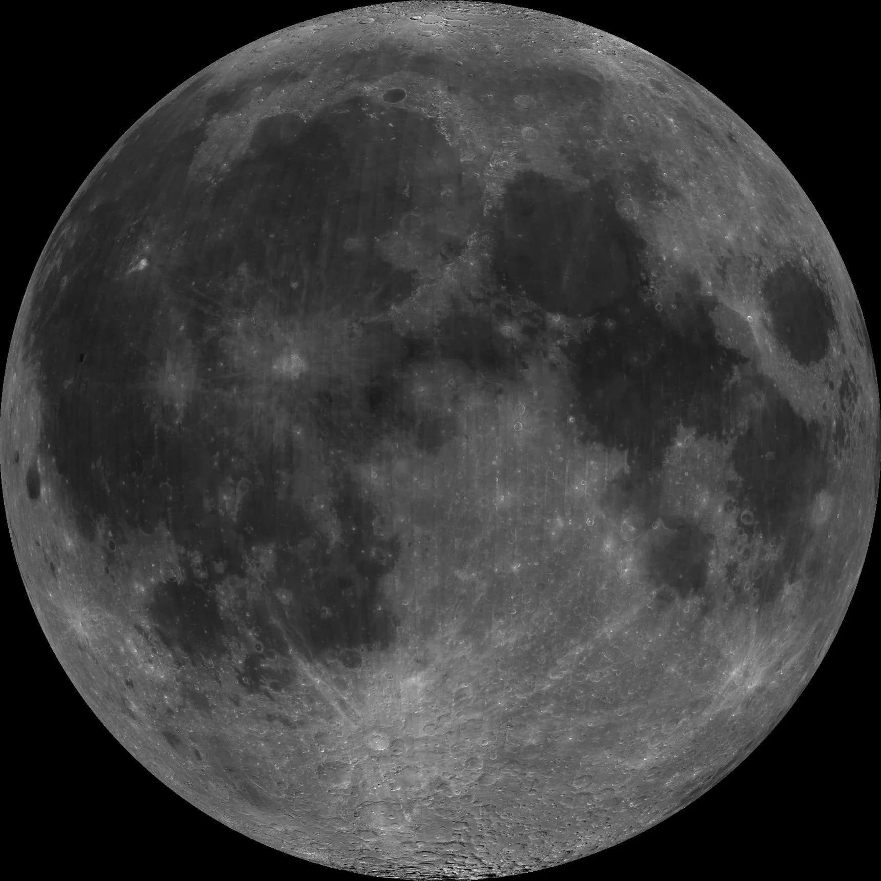 Loading coastlineExploratory fit
Lunar base: NASA/JPL/USGS Clementine mosaic. Coastline: Natural Earth public-domain data.
Clementine 750 nm nearside mosaic centered at 0 degrees latitude and longitude. NASA/JPL/USGS.
First identify the pattern.
NASA/JPL says roughly 50,000 Clementine frames were processed into this orthographic view. The dark regions are low-albedo maria; about 30 percent of the nearside is mare terrain.
Impact basins and later basaltic volcanism created the large shapes. Their edges are irregular, nested among craters, rays, highlands, shadows, and imaging artifacts. That gives an observer many possible boundaries to trace.
Inspect the image recordTurn resemblance into a claim that can fail.
The strongest next test is not another adjusted overlay. It is a mapping rule written down before unused features are revealed.
Freeze the source
Name the exact lunar image, date, processing, hemisphere, and orientation.
Define the projection
Specify how every Earth latitude and longitude becomes a point on the lunar disk.
Separate fit from test
Use one set of landmarks to fit the transform and a different set to evaluate it.
Set the tolerance
Decide in advance how close a coastline and lunar boundary must be to count as a hit.
Compare a control
Run the same procedure against unrelated natural patterns and alternative transforms.
What the overlay establishes.
Keep the resemblance as an observation. Do not quietly promote it into a mechanism.
It does establish
- Lunar albedo boundaries can evoke familiar geographic shapes.
- Some Earth outlines can be visually aligned with selected lunar regions.
- A precise version of the proposal can be tested with coordinates.
It does not establish
- That one unique projection maps all Earth geography to lunar features.
- That the proposed correspondences predict unused landmarks better than controls.
- That a reflection, plasma image, or hidden continent mechanism exists.
Source trail
The first link defines the claim. The rest establish the image, geology, geometry, data, and perception needed to test it.
Plasma Moon Map Flat Earth Model
Journal of Geocentric CosmologyIncluded to define the modern claim on its own terms: processed lunar features are treated as a polar-style map that includes known and hidden lands.
Open sourceNearside of Earth's Moon as Seen by Clementine
NASA Jet Propulsion LaboratoryDocuments the fixed 0 degree latitude, 0 degree longitude orthographic mosaic used in the overlay lab and explains its albedo data.
Open sourceMoon Craters
NASA ScienceExplains that the dark maria behind familiar lunar figures are basalt-filled impact basins and describes how those basins formed.
Open sourceMoon Phases: Our Wobbly Moon
NASA ScienceShows how libration and observer orientation make the apparent lunar disk shift and rotate over time.
Open sourceHow Are Different Map Projections Used?
U.S. Geological SurveyStates the central constraint: every flat Earth map distorts some combination of area, distance, direction, or shape.
Open sourceLunar Grid Systems, Coordinate Systems, and Map Projections
U.S. Geological SurveyDefines reproducible lunar reference frames and projection systems, showing what precise feature-to-feature registration requires.
Open sourceNatural Earth About and Terms
Natural EarthProvides the public-domain 1:110 million land geometry drawn by the interactive overlay.
Open sourceSeeing Shapes in Seemingly Random Spatial Patterns
PLOS ONE via PubMed CentralTests how edge complexity in ambiguous patterns can induce many recognizable forms, including in natural scenes and lunar surfaces.
Open sourceLearn to read both maps.
A lunar atlas and a cartography primer make the comparison more interesting because named features, coordinates, and projection choices replace freehand resemblance.
We may earn a commission if you buy through these links, at no extra cost to you.
Browse the map reading pathBuild an observation kitContinue the investigation
Open questionHave observers recorded real short-lived lights or color changes?
Some flashes are real impacts. A specific report still needs timing, fixed position, signal shape, and independent corroboration.